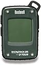
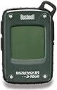
Bushnell BackTrack D-Tour Personal GPS Tracking Device
Product ID: 936555
Buy anything from 5,000+ international stores. One checkout price. No surprise fees. Join 2M+ shoppers on Desertcart.
Desertcart purchases this item on your behalf and handles shipping, customs, and support to Japan.
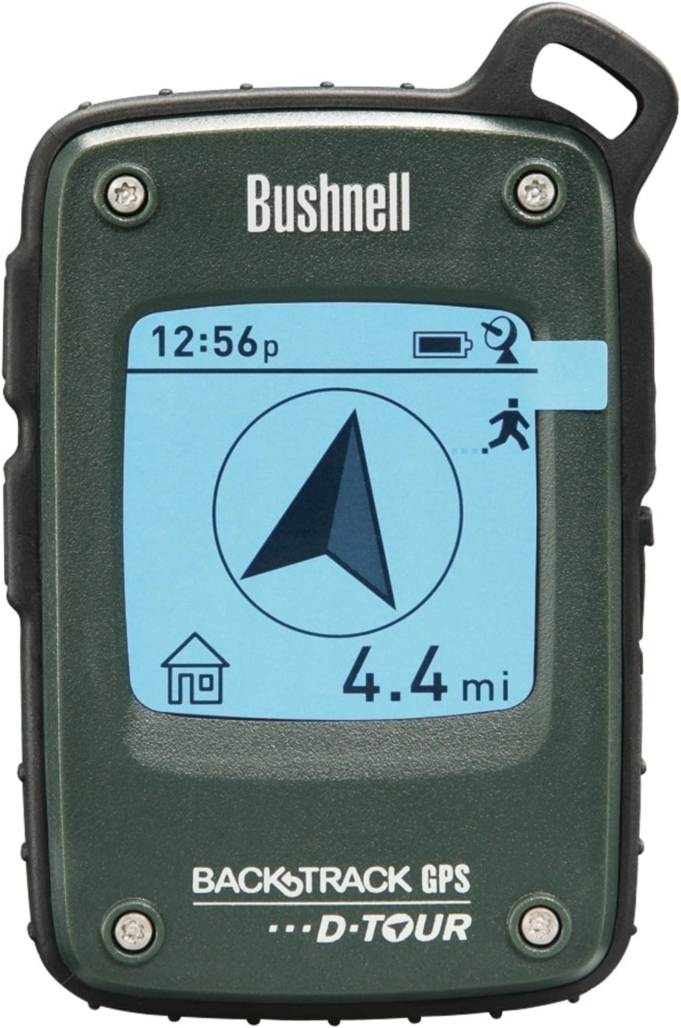
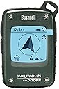
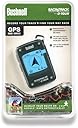
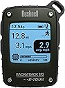
Product description GPS made simple! Long after your cell service has faded, the Bushnell BackTrack D-TOUR has you covered. With up to five storable locations, the D-TOUR allows you to not only save trailhead and campsite locations, but also log that hidden fishing spot where you caught last night's dinner. In addition to providing simple distance and direction, the D-TOUR includes a self-calibrating digital compass, time, temperature, altitude and latitude/longitude coordinates. Best of all, once you return from that epic adventure, you can easily upload up to 48 hours worth of data to a PC or Mac to relive the experience and share it with friends. At just six ounces and compact enough to store in a pocket or clip to your pack, the D-Tour will quickly become your preferred personal GPS. .com Keep track of every journey with the D Tour Personal GPS Tracking Device from Bushnell. High-functioning GPS capabilities and a precision digital compass with latitude and longitude allow you to track any course by automatically keeping track of time, temperature, and altitude, along with route, length and speed. You can mark and store up to five locations on the GPS and 24 hours worth of data. A great exercise tool, the D Tour can help track your fitness by recording your time and distance, charting your progress and helping you meet your goals. Hunters can keep track of territories, while boaters and fishers will find the GPS useful for navigation and marking sweet spots. After your workout, trip, or adventure, share you results on Facebook, email them to yourself or a friend, and save them to your computer. What's in the Box? Package Includes: 1 D-Tour GPS unit, 1 Quick-start guide, 1 USB cable Keep track of your progress or routes by uploading D Tour data to your computer. Features: Personal GPS Tracking Device with precision accuracy Allows you to mark and store up to 5 locations Automatically records time (military and civilian), temperature, and altitude Weather-resistant construction Records course taken, length in miles and yards or meters and kilometers, speed, temp, and elevation Precision digital compass with latitude and longitude Allows you to easily share data via social media, email or save to computer Accelerometer accuracy Logs up to 48 hours of trip data Keep track of repeated exercise paths Upload to social media, email, or computer The D-Tour records course taken, length in miles and yards or meters and kilometers, speed, temperature, and elevation. Specifications: Screen size: 1.625 by 1.625 Weight: .25 pounds with batteries Screen Type: Grayscale LCD Power source: 3 AAA batteries (not included) Unit Dimensions: 2.75 by 4.125 by .875 inches (W x H x D) Runs on Windows (XP SP1 or later) and MAC (10.4.9 or later) 1 Year Limited Warranty Best Uses: Hiking Biking Running/Fitness/Outdoor Exercise Hunting Boating/Fishing
R**N
Met My Needs But With Two Issues
I had purchased a previous version of this personal GPS in September 2011. I walk 5 to 7 miles around my neighborhood several days a week. I have a pedometer to measure my steps, and I wanted some device to track where I walked and to provide the time and distance. I saw a review in the LA Times and purchased the device. Earlier this year, it started to act up by throwing positions in the mid-Atlantic Ocean. I didn’t walk at teleportation speeds! I went looking for a replacement device.My criterion for selecting a device was that device must provide an off-device ability display the route of my walk with the time and distance. I was not looking for the device to display my location on a map or provide me with directions to a location.My old and my current BackTrack D-Tour deices fulfill that criterion excellently. When I finish a walk, I connect the device to my computer and download the data to software that Bushnell provides. My track is displayed on a map with the distance to a hundredth of a mile and time to the second that I walked. I can switch to a satellite picture to have my track superimposed upon that. With years of tracks, I can tailor my walks to achieve specific distances and times to suit my needs.No device is perfect. Both my old and current device have two issues that you should consider before purchasing.First, when I turn it on, I have a set one of the five available locations to the center of my driveway where I start and stop my walks. Often, while standing exactly in the same location that I set the location’s position, the device will tell me that it is 10 to 30 yards in some direction. With time, it will slowly to zero or stabilize at a smaller number. The resulting small error of a few yards is has not bothered me when I walk miles. Also, after displaying my track on the computer on a map, it appears that the accuracy is a few yards, so the tracks may look like as I was walking a little drunk, but the result is quite acceptable to me.Second, after I’ve decided that the GPS has me close enough to my starting location, a button must be pressed to shift it to the screen to start and stop tracking. With both my old and current devices, it takes patience doing this. I have pressed from firmly to strongly; I have pressed every corner and edge of the button. This can take up to a minute. Once on this screen, depressing the button continually for a few seconds, and the device starts or stops the tracking.Overall, I am happy to use this device and recommend it. I will give it only four stars because if the problem is switching to the tracking screen that has been persistent in both devices I owned. I hope that this review has provided you with adequate information to make a decision.
R**H
Does what it says and great for that purpose. Think about what you want, this may be it. It was for me.
I didn't need a big time GPS unit but I wanted something to record hikes other than the GPS in my phone. This it the gadget you need for that. Low power usage, and it's simple to carry 3 extra AAA batteries anyway. It will guide you back (directionally not step by step) to a set waypoint. You do have to be AT the waypoint to set it you cannot program in coordinate (note the name is "BACKtrack"). It will guide you BACK. Back to camp, back to the trail head, or back to your car, whatever you set. It can track your course in a vehicle at highway speed. Gets a satellite fix pretty quickly (1-2 minutes for me). It says it will store about 22 hours, but keep in mind that's 22 hours of movement you wouldn't need it on while in camp etc. Also if you do need to change batteries, it will not lose your data (that's a big deal by the way).You can upload your information, which it will overlay with google earth and show speed, distance, elevation etc. Probably more info than you need. It can also display your GPS position which would help you locate yourself on a map (ALWAYS have a map and compass). The digital compass function seems to work well (ALWAYS take a regular magnetic compass).For the price this does exactly what I wanted: 1. Tracks my hike & will upload it. 2. Display my GPS position. 3. Can guide you back if needed.If that's what you want get this item. If you want to geocache, or set destinations to be guided to, or show your position on a map overlay and so on then you'll need to shell out the bucks for a big time GPS unit.
A**R
use a phone app instead
I have had this for a little over a year. I hike a lot in the mountains and sometimes go off trail, which is one reason I wanted the "backtrack" function. At first I liked it -- basic, easy to use, and gave info that I wanted, such as distance traveled, backtrack direction and distance to 5 different locations, a compass, and altimeter. Easy to use and easy to read, rugged, nice compact size. Once you download the file, you can (or could, but no longer) view your route on satellite view, map view (just a line on vaguely shaded map), or terrain view (topographic). Then you could export or print the view. I liked having maps of my hikes.Deal killers: You can't pause the tracking and it doesn't have an energy saving mode, so I'm lucky if it logs for 8 hours. That means a lot of my hikes have not been completely logged before the batteries die; I use rechargeable batteries, always fully charged, but maybe that has something to do with it. After a year, it doesn't log the distance accurately (I compare against other mapping apps and routes with known distances). Recently the software was updated and it no longer provides the topographic map view. That means that all you get to see is a line on a shaded relief. When I contacted customer support they said they farm out the Backtrack software to some other company. Follow a link to that site and there's no information, support, or customer support or anything. In fact, you can't even tell what the company does.Overall, accuracy of functions has diminished over time, poor software and no support from Bushnell. Given that there are a lot of mapping and compass apps for smart phones, there's no point in even bothering with this unit, disappointing since I liked it a lot at first.
P**E
This product is awful
Its file format is proprietary and you have to send the files off to somewhere else on the planet to get the results (Q. are they so bad that hey have to be massaged to make sense?). What is wrong with having something that can be displayed on Google or something else (something offline???) - why do they need to know where we have been as a cost of us getting to find out where we have been?A lot of the time, it cannot get any signal and for some reason, it only gives you the time truncated to the minute - considering that the time it has is by definition going to be accurate to a degree far in excess of the latency of an LCD display.When it does work, the locator function (your car/home/tent/whatever is so many km/miles away, in that direction) is quite good but you can only define these points by going there (what is wrong with typing in co-ordinates?).I received mine as a present and the giver has only ever apologised for inflicting this product on me. I don't use it any longer.
M**N
Bushnell Back Track GPS
It is simple to use, effective and small enough to carry around without any problem. An ideal tool for any family member young or old.I tried it out in out local park/woods and it brought me back within a metre from where i set out, so the accuracy was spot on which is what the device is all about, finding your way back!
S**R
Mixed feelings
Device offers a very useful set of features. When they work, they are really impressive. However, I have had the following issues:* Often struggles to get a satellite signal and I can be waiting a few minutes before I get one.* Has had problems at a particular site where I have tried using it - could be a strong magnetic field there perhaps (near airport) ?* I wanted to install software on Linux but was not able to do so even though this has been done before from what I have read.* Don't expect any response from Bushnell support. I sent emails to two addresses they list on their site and neither has responded. They do not appear to offer a telephone number to call them.* The software which one downloads is a different version to that illustrated in the manual. The new version does not allow you to save to a local file nor does it offer a Hybrid mode map. It seems they have removed features rather than adding them.* Software feature for sharing on Facebook does not appear to work either.
F**N
Einwandfrei und besser als vermutet...
Nach dem Lesen der bereits abgegebenen Rezensionen hatte ich eigentlich damit gerechnet, dass ich zumindest teilweise von dem Bushnell enttäuscht sein würde. - Aber nichts davon!Das D-Tour hat in sechs verschiedenen weit verstreuten Regionen ohne lange Wartezeiten Satellitenverbindung hergestellt und Positionen exakt bestimmt. Tracking der jeweils mehrstündigen Wanderungen ging problemlos, übertragen der Daten auf den Rechner (bzw. den Bushnell-Server) erfolgt von alleine...Für mich das Wichtigste: Die Trip-Daten und Wegepunkte stimmten exakt mit den von mir (sonst mit einem Kompass) benutzten topographischen Karten überein.Wo die anderen Rezensenten Probleme mit dem Batteriefach gehabt haben können, lässt sich von mir nicht nachvollziehen. Es ist dicht, das genügt mir... - Obwohl ich das D-Tour frei am Rucksack hängen habe, blieb das Batteriefach auch bei strömendem Regen trocken.Die für seine Einsatzbereiche benötigten Features funktionieren beim Bushnell D-Tour perfekt... Dazu ist robust, leicht und handlich.Kann man mehr erwarten?
T**S
Nettes Design aber kein Export
Das D-Tour ist vom Design und der Bedienung sehr einfach gehalten, was erstmal ein gutes Zeichen wäre. Nur leider können die Tracks nicht richtig exportiert werden, sondern nur in der Bushnell eigenen App angeschaut werden. Darüber hinaus braucht man einen Bushnell Account, der auch nach der Rückgabe nicht gelöscht wird. Ich war sehr damit unzufrieden und habe es zurück geschickt.Das eTrex10 von Garmin bietet für den gleichen Preis wesentlich mehr Funktionen und wäre meine Kaufempfehlung für alle GPS Einsteiger.
Trustpilot
2 months ago
1 week ago